Rally Raid Game Homepage

Content
Introduction
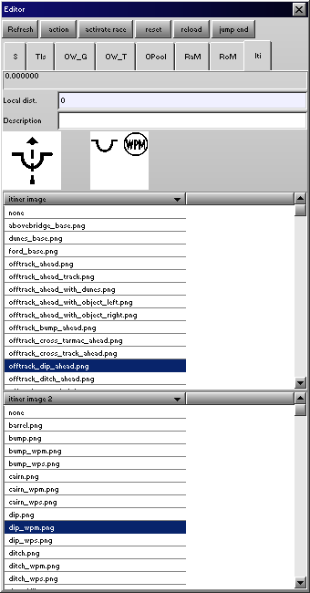
The most important part of the navigation system is the road book. You can place road book elements (called itinerary point) along the stage.

Description
| total distance | (at the top of the tab) total distance that is determined by the summary of the local distances of each element. It is in meters. |
| Local dist. | the distance from the previous itinerary point, it is very important, be punctual. It is in meters. |
| Description | you can add some extra information to each road book entry: CAP, dangerous level. |
| Itiner image | this will be the tulip image. Mostly describes the direction. |
| Itiner image 2 | will be the part of the description. Some extra visual information. |
Help For Calculation The Local Distance
If you edit the stage step by step: go along the stage and place AI and itinerary points at a time then the editor will help in the calculation of the calculation.How?
For example, at the start:
- place AI point at the begin, where the race should start.
- place the start itinerary point (local distance: 0, description: START, itiner image: track_ahead.png, itiner image 2: start_with_clock.png)
- AI-iti: 0 will be appear in the stage length info on the editor - main window - selection tab - selection table
- place AI points along the stage to the next action point which you should add to the road book. (the AI-iti number will increase, and tell the distance from the last itinerary point in meters)
- go the Local dist. input if the itinerary tab and press Enter. The AI-iti number will be writen into the local distance.